Description
SlantView-An agriculture software
SlantRange is been working in the area of spectral imaging for application in agriculture. Spectral or hyper spectral imaging, provides a digital image with more color information for every pixel then compared to human eye or normal cameras. With the advent of drones and intelligence system powering them, spectral imaging becomes a powerful tool for collection of imaging data and processing it faster. SlantRange’s software SlantView is designed to process data four times faster compared to traditional software.
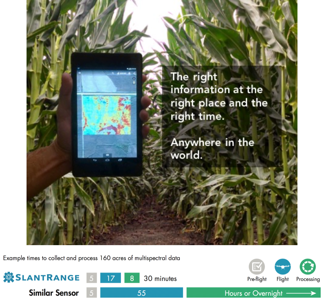
With modern computer vision techniques, SlantView provides information such as plant size, weed growths, Health surveys and can be used for, plant specific or complete field survey based on individual requirements. Further, leaking in irrigation system or areas under stress (the plant chlorophyll levels and other characteristics changes during stress) due to infection can be detected using the software.
Moreover, internet may not be accessible in some areas and so data uploading to the cloud can be an expensive affair. However, data can be processed in the software without any need of network connections, just collect the data, analyze it and work on it right from the field.
SlantView is an amazing handy product for the farmers and can surely help in improving working efficiency and productivity.