বর্ণনা
SpaceSense offers a comprehensive suite of solutions designed to enhance agricultural productivity through the use of advanced satellite imagery and AI technologies. These tools are pivotal for modern agriculture, providing critical insights into crop health, pest detection, and resource management, which support sustainable and efficient farming practices.
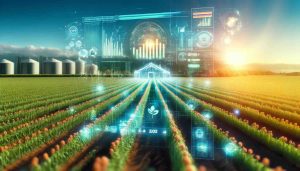
Advanced Monitoring for Precision Agriculture
SpaceSense uses a robust platform that integrates satellite data with AI to deliver precise agricultural insights. This integration allows farmers to monitor crop health across vast areas, detect early signs of distress or disease, and optimize the application of resources. By leveraging data from multiple satellite sources, including optical, radar, and hyperspectral images, SpaceSense provides a detailed view of agricultural lands, surpassing the common limitations of cloud coverage and imaging discrepancies.
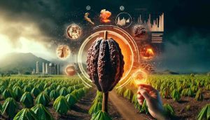
AI-Driven Insights and Analytics
The core of SpaceSense’s offering is its AI-driven analytics, which process remote sensing data to produce actionable insights. This technology facilitates a range of applications:
- Crop Health Monitoring: Continuous surveillance of crop vitality and stress levels to ensure optimal growth conditions.
- Pest and Disease Detection: Timely identification of potential threats to enable swift intervention, reducing crop loss and chemical use.
- রিসোর্স অপ্টিমাইজেশান: Precision in the application of water, fertilizers, and pesticides, leading to cost savings and reduced environmental impact.
- Yield Forecasting: Predictive analytics that estimate crop yields, helping farmers plan better and market their produce effectively.
প্রযুক্তিগত বিবরণ
- Data Types: Optical, Radar, Hyperspectral
- Image Processing: AI-enhanced analysis ready data (ARD)
- কাস্টমাইজেশন: User-specific settings for data processing and analysis
- পরিমাপযোগ্যতা: Capable of handling data from individual fields to entire countries
- মিশ্রণ: Easy integration with existing farm management systems
About SpaceSense
SpaceSense is based in Paris, France, and has quickly emerged as a leader in the satellite imagery analysis sector, particularly within the agricultural domain. The company’s mission is to democratize access to satellite data, making it a standard tool for agronomists and farmers globally. With a diverse and international team, SpaceSense is committed to continuous innovation in geospatial data utilization.
অনুগ্রহ করে দেখুন: SpaceSense’s website আরও তথ্যের জন্য.