Mô tả
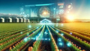
Landscan.ai is an advanced agricultural analytics platform designed to enhance crop and land management through the creation of digital twins for agricultural fields. By integrating high-resolution vegetation sensing with digital soil profile scanning, Landscan.ai provides precise, actionable insights that support sustainable farming practices and optimize crop yields.
Field Intelligence
Landscan.ai’s field intelligence leverages advanced satellite imagery processing and geospatial data analytics to baseline and continuously monitor fields. This comprehensive approach integrates various data sources, including satellite and drone imagery, to deliver detailed insights into field conditions, enabling precise and timely agricultural interventions.
Digital Vegetation Signature (DVS™)
The Digital Vegetation Signature (DVS™) technology utilizes a combination of spectral, hyper-spatial, thermal, geomagnetic, and LIDAR data collected from drones and airplanes. This integration allows for the creation of management zones, targeted scouting, and monitoring of vegetation health over time. The DVS™ provides critical information for managing crop vigor and stress, contributing to effective precision farming.
Digital Soil Core (DSC™)
The Digital Soil Core (DSC™) system offers a groundbreaking approach to soil analysis. The DSC™ measures soil properties throughout the root zone using multiple sensors, including those for tip force, sleeve friction, dielectric permittivity, and electrical resistivity. This detailed soil profile informs soil management practices by providing accurate data on soil composition and health.
Dynamic Modeling
Landscan.ai’s dynamic modeling capabilities integrate DVS™ and DSC™ data to support robust decision-making processes. These models enable the management of crops within statistically derived zones, optimizing water usage, fertility, and plant growth processes. Dynamic modeling ensures that agricultural practices are both efficient and sustainable.
Root Cause Analytics (RCA™)
The Root Cause Analytics (RCA™) system combines site characterization and plant performance metrics to provide continuous improvement in crop analytics. This feature identifies and addresses the root causes of issues, ensuring that production systems are optimized for maximum efficiency and yield.
Thông số kỹ thuật
- Platform: Datum Geospatial Platform
- Vegetation Sensing: Spectral, Hyper-spatial, Thermal, Geomagnetic, LIDAR
- Soil Sensing: Tip Force, Sleeve Friction, Dielectric Permittivity, Electrical Resistivity
- Resolution: High-resolution spatial data
- Depth: Soil profile characterization up to 120cm
- Tích hợp dữ liệu: Satellite, drone, and in-situ sensors
- Models: Dynamic decision support models
- Analytics: Root Cause Analytics system
About Landscan.ai
Based in Davis, California, Landscan.ai is a leader in agricultural analytics. The company was founded with the mission to leverage advanced engineering, agronomy, and data science to optimize agricultural production. Landscan.ai’s team consists of experts who have pioneered soil and vegetation mapping technologies, and their innovative solutions are deployed globally, across six continents.
Landscan.ai provides critical insights and decision support for some of the world’s largest and most influential farming companies, helping them achieve precision farming goals. The platform is designed to integrate seamlessly into existing agricultural practices, providing a scalable and sustainable approach to modern farming.
Vui lòng truy cập: Landscan.ai’s website.