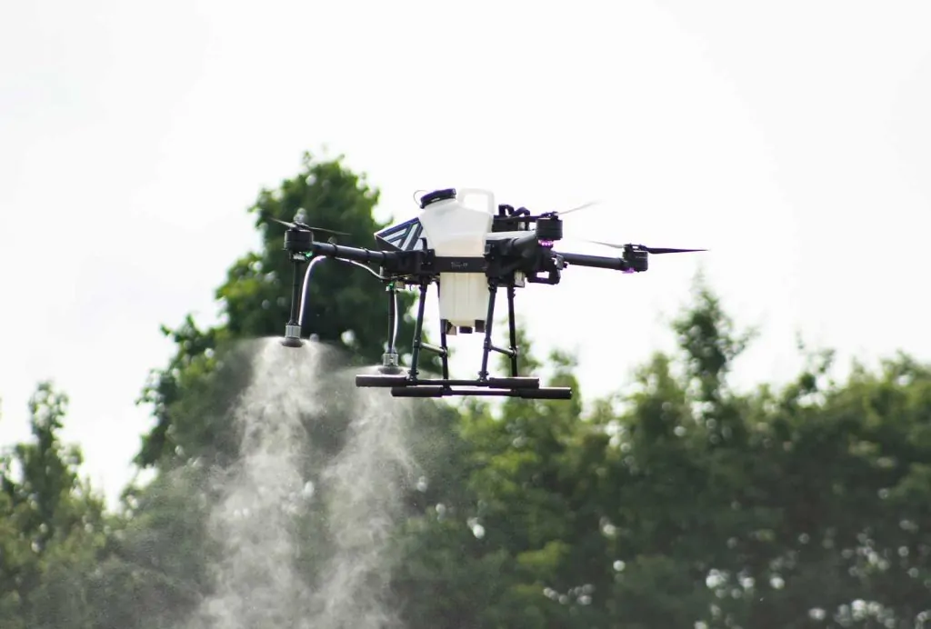
PrecisionHawk is at the forefront of agricultural technology, providing farmers with a comprehensive drone and data analytics solution. By leveraging unmanned aerial vehicles (UAVs) and advanced data processing techniques, PrecisionHawk enables users to gain valuable insights into crop health, optimize resource allocation, and improve overall farm management practices. This technology empowers farmers to make data-driven decisions, leading to increased efficiency, reduced costs, and enhanced yields.
Founded with the vision of transforming agriculture through aerial intelligence, PrecisionHawk has developed a complete ecosystem of drones, sensors, software, and data analytics tools. This integrated approach ensures seamless data capture, processing, and analysis, providing farmers with actionable information at their fingertips. From monitoring crop health and detecting diseases to forecasting yields and optimizing irrigation, PrecisionHawk offers a wide range of applications to address the diverse needs of modern agriculture.
PrecisionHawk's commitment to innovation and customer success has made it a trusted partner for farmers around the world. By providing cutting-edge technology and expert support, PrecisionHawk is helping farmers unlock the full potential of their land and build a more sustainable future for agriculture.
Key Features
PrecisionHawk's key features revolve around its integrated approach to drone-based data acquisition and analysis. The system utilizes a variety of sensors, including visual, multispectral, hyperspectral, thermal infrared, and LiDAR, to capture comprehensive data about crop health, soil conditions, and other relevant factors. This data is then processed using advanced algorithms and machine learning techniques to generate actionable insights for farmers.
One of the most notable features of PrecisionHawk is its PrecisionAnalytics Agriculture platform. This platform provides a user-friendly interface for accessing and analyzing aerial data, enabling farmers to quickly identify areas of concern and make informed decisions about crop management. The platform also includes tools for creating prescription maps, which can be used to optimize the application of fertilizers, pesticides, and other inputs.
Another key differentiator of PrecisionHawk is its Beyond Visual Line of Sight (BVLOS) flight capabilities. This allows drones to fly longer distances and cover larger areas, increasing the efficiency of data collection. The DataMapper software is also a crucial component, allowing for the processing of aerial imagery into 2D/3D orthomosaic maps, which provide a detailed and accurate representation of the field.
Furthermore, the PrecisionFlight mobile app ensures quality data tags for DJI drones and PrecisionHawk Lancaster, streamlining data collection and ensuring data integrity. This complete ecosystem ensures that farmers have access to the tools and information they need to make data-driven decisions and improve their bottom line.
Technical Specifications
| Specification | Value |
|---|---|
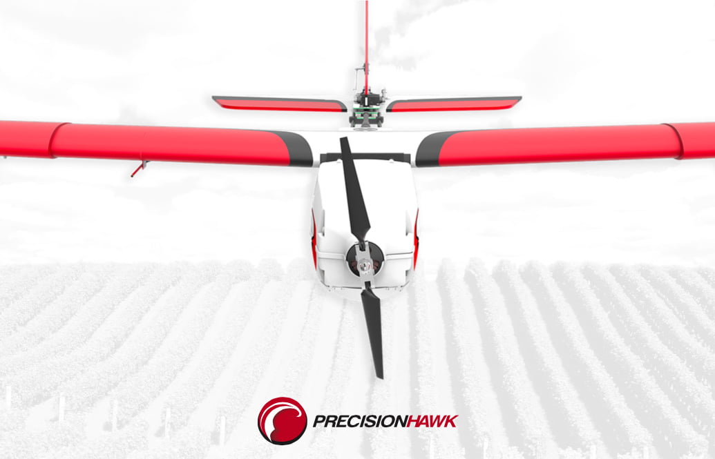
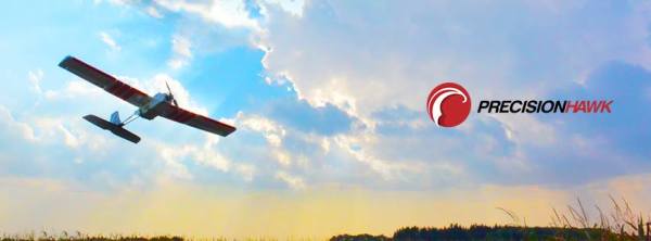
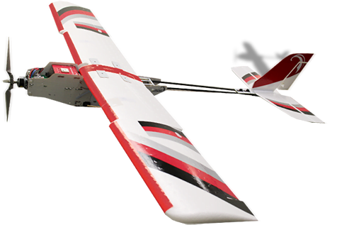
| Drone Type | Fixed Wing (e.g., Lancaster 5) |
| Weight (no payload) | 2.4 kg (Lancaster 5) |
| Max Takeoff Weight | 3.55 kg (Lancaster 5) |
| Wingspan | 1.5 m (Lancaster 5) |
| Cruise Speed | 12-16 m/s (Lancaster 5) |
| Max Speed | 22 m/s (Lancaster 5) |
| Survey Altitude | 50-300 m |
| Max Operating Altitude | 2500 m |
| Survey Area per Flight | Approx. 300 acres at 100m altitude |
| Flight Time | Up to 45 minutes (Lancaster 5) |
| Sensor Compatibility | Visual, Multispectral, Hyperspectral, Thermal Infrared, LiDAR |
| Operating System (Software) | iOS, Android |
Use Cases & Applications
PrecisionHawk's technology finds applications across various aspects of farm management. Here are some concrete examples:
- Early Disease Detection: Farmers use PrecisionHawk to monitor crop health and detect early signs of diseases or insect infestations. By identifying problems early, they can take targeted action to prevent widespread damage and minimize yield losses.
- Optimized Irrigation: PrecisionHawk's aerial imagery and data analysis can be used to assess soil moisture levels and identify areas that require more or less water. This allows farmers to optimize irrigation practices, conserve water, and improve crop yields.
- Yield Forecasting: By analyzing crop health and growth patterns, PrecisionHawk can help farmers forecast yields more accurately. This information can be used to make informed decisions about harvesting, storage, and marketing.
- Crop Insurance Assessment: In the event of crop damage from wind, hail, or flood, PrecisionHawk can provide detailed aerial imagery and data analysis to support insurance claims. This helps farmers recover losses and get back on their feet more quickly.
- Livestock Monitoring: PrecisionHawk can be used to monitor livestock populations, track their movements, and assess their health. This can help farmers improve livestock management practices and prevent losses from disease or theft.
Strengths & Weaknesses
| Strengths ✅ | Weaknesses ⚠️ |
|---|---|
| Comprehensive data acquisition with multiple sensor options | Initial investment costs for drone and sensors can be significant |
| AI-powered analytics for actionable insights | Requires training and expertise to operate drones and interpret data effectively |
| BVLOS capabilities for increased data capture area | Weather conditions can impact flight operations and data quality |
| Integrated ecosystem of drones, sensors, and software | Data processing and analysis can be time-consuming without proper infrastructure |
| Versatile applications across various crops and farming types | Regulatory restrictions on drone flights may limit usability in some areas |
Benefits for Farmers
PrecisionHawk offers numerous benefits for farmers, including time savings, cost reduction, and yield improvement. By automating crop monitoring and providing actionable insights, PrecisionHawk helps farmers save time and effort on scouting and data collection. The technology also enables farmers to optimize input management, reducing costs associated with fertilizers, pesticides, and water. Ultimately, PrecisionHawk leads to improved yields and increased profitability by enabling farmers to make more informed decisions about crop management.
Furthermore, PrecisionHawk contributes to sustainability by promoting efficient resource utilization and reducing environmental impact. By optimizing irrigation and fertilizer application, farmers can conserve water and minimize nutrient runoff, protecting water resources and reducing pollution. The early detection of crop diseases and insect infestations also reduces the need for pesticides, promoting a more sustainable approach to agriculture.
Integration & Compatibility
PrecisionHawk is designed to integrate seamlessly into existing farm operations. The software is compatible with various farm management information systems (FMIS) and precision agriculture platforms, allowing for data export in standard formats. The PrecisionFlight app is specifically designed to work with DJI drones and PrecisionHawk Lancaster, ensuring compatibility with popular drone models. This integration enables farmers to leverage the benefits of PrecisionHawk without disrupting their existing workflows and systems.
Frequently Asked Questions
| Question | Answer |
|---|---|
| How does PrecisionHawk's AI work for agriculture? | PrecisionHawk uses advanced AI and machine learning algorithms to analyze aerial imagery captured by drones. This analysis identifies plant health, counts plants, sizes canopies, and detects anomalies, providing farmers with actionable insights for improved crop management and yield optimization. |
| What is the typical ROI with PrecisionHawk? | The ROI varies depending on farm size, crop type, and specific applications. However, farmers can expect to see cost savings through optimized input management (water, fertilizer), early detection of crop diseases, and improved yield forecasting, leading to increased profitability. |
| What setup/installation is required for PrecisionHawk? | The setup involves drone deployment, sensor integration (if applicable), and software installation on a compatible device (iOS or Android). Users will also need to establish ground control points for accurate georeferencing of aerial imagery. Training is recommended to ensure proper operation and data interpretation. |
| What maintenance is needed for the drones and software? | Drones require regular maintenance, including battery checks, propeller inspections, and sensor calibration. The software receives periodic updates, which should be installed to ensure optimal performance and access to the latest features. Data storage and management also require ongoing attention. |
| Is training required to use PrecisionHawk effectively? | Yes, while the software is designed to be user-friendly, training is highly recommended to maximize the benefits of PrecisionHawk. Training covers drone operation, data acquisition, software usage, and data interpretation, enabling users to make informed decisions based on the insights generated. |
| What systems does PrecisionHawk integrate with? | PrecisionHawk integrates with various farm management information systems (FMIS) and precision agriculture platforms. The software allows for data export in standard formats, facilitating seamless integration with existing workflows and decision-making processes. PrecisionFlight is designed to work with DJI drones. |
| How does PrecisionHawk help with crop insurance? | PrecisionHawk provides detailed aerial imagery and data analysis that can be used to assess crop damage from wind, hail, or flood. This data can also be used to inventory crops and assess their total value, providing valuable documentation for insurance claims. |
| What is the LATAS platform? | LATAS, or Low Altitude Traffic and Airspace Safety platform, is a feature designed for drone safety and airspace management. It helps operators ensure compliance with regulations and avoid potential conflicts with other aircraft. |
Support & Training
PrecisionHawk offers comprehensive support and training programs to ensure that users can effectively utilize the technology and achieve their desired outcomes. Training programs cover drone operation, data acquisition, software usage, and data interpretation. Ongoing support is available through online resources, technical documentation, and expert assistance.
Pricing & Availability
To learn more about PrecisionHawk's pricing and availability, contact us via the Make inquiry button on this page.