")
[1]")
")
Description
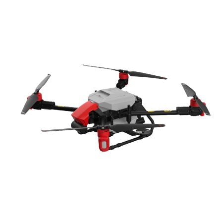
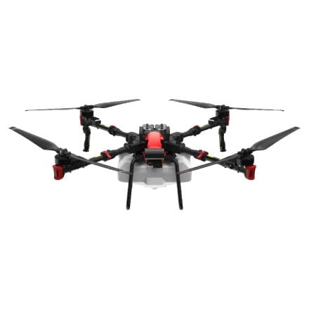
The PrecisionVision PV35X, developed by Leading Edge Aerial Technologies, represents a significant advancement in aerial mapping and surveying technology, particularly designed for the agriculture sector. This drone is not just about capturing high-resolution images from the sky; it’s a comprehensive tool that aids in making informed decisions through precise land and crop analysis. Its integration into agricultural practices marks a step forward in precision agriculture, enabling users to monitor crop health, assess land conditions, and manage resources more effectively.
Advanced Aerial Mapping Capabilities
The core strength of the PrecisionVision PV35X lies in its sophisticated aerial mapping capabilities. Equipped with a 35x optical zoom camera, it brings unparalleled clarity and detail to aerial imagery, making it possible to identify issues that would not be visible to the naked eye or through standard cameras. This level of detail is crucial for early detection of pests, diseases, and irrigation problems, allowing for timely intervention and management.
Enhanced Crop Monitoring
Effective crop monitoring is essential for maximizing yield and efficiency in farming operations. The PV35X facilitates this by providing high-resolution images that help in the assessment of crop health, growth stages, and density. This data is invaluable for adjusting farming practices in real-time, such as optimizing water usage, fertilizer application, and harvesting schedules.
Technical Specifications
- Camera: Equipped with a 35x optical zoom for detailed imagery
- Flight Time: Capable of up to 30 minutes of continuous flight
- Operational Range: Offers a range of up to 7 kilometers
- Image Resolution: Delivers high-definition images for precise analysis
- Mapping Accuracy: Ensures sub-centimeter accuracy in mapping outputs
About Leading Edge Aerial Technologies
Leading Edge Aerial Technologies stands at the forefront of innovation in the field of aerial survey equipment. Based in the United States, the company has a rich history of developing drones that are not only technologically advanced but also tailored to meet the specific needs of the agricultural sector. Their commitment to quality and precision has made them a trusted name among farmers, agronomists, and agricultural researchers worldwide.
The development of the PrecisionVision PV35X is a testament to Leading Edge’s dedication to pushing the boundaries of what’s possible in precision agriculture. By providing tools that offer detailed insights into crop and land conditions, they empower the agricultural community to make informed decisions that lead to improved productivity and sustainability.
For more information on Leading Edge Aerial Technologies and their innovative solutions, please visit: Leading Edge Aerial Technologies website.
The PrecisionVision PV35X is more than just a drone; it’s a pivotal tool for modern agriculture, offering detailed insights that help in optimizing farming operations. Its technical specifications and capabilities reflect Leading Edge Aerial Technologies’ commitment to supporting the agricultural sector with advanced, reliable, and precise tools. Whether it’s for large-scale farming operations or research purposes, the PV35X stands ready to deliver exceptional performance and valuable data, making it a worthy investment for those looking to enhance their agricultural practices.